Paisley Harbour was once bustling with thousands of tonnes of cargo being landed every month.
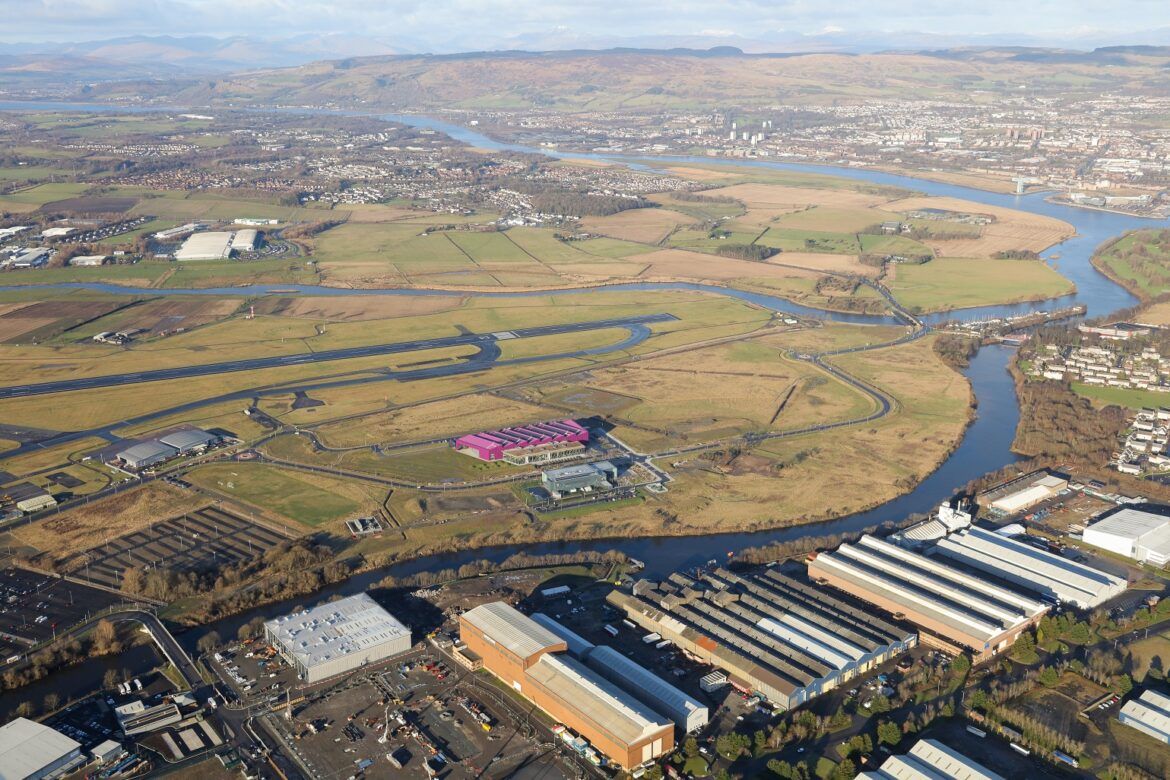
Located on the White Cart river just off the town’s Harbour Road, the harbour dates back to the 1600s.
At first too shallow for large vessels, the river was deepened and straightened in 1835 with a harbour built at Carlile Quay.
A further harbour followed at Laighpark by 1880, supporting three nearby shipyards.
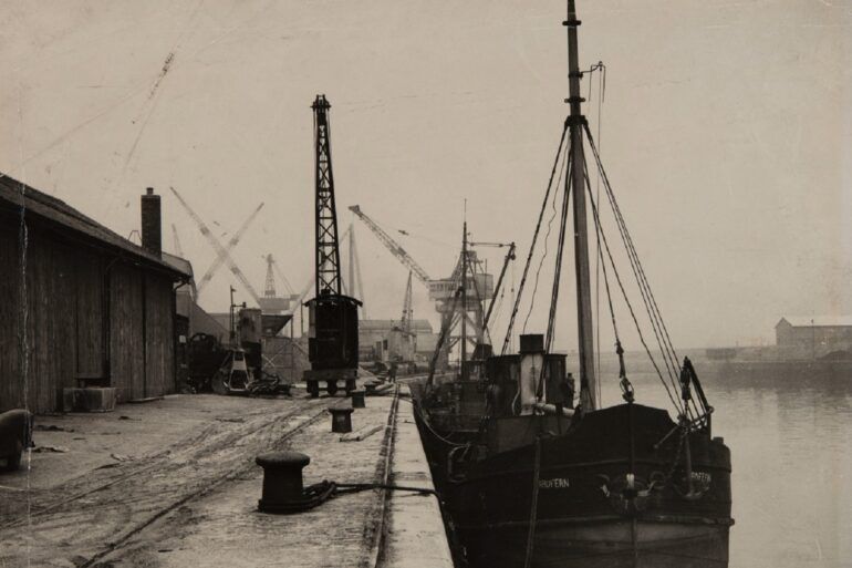
Paisley’s shipyards received many orders during WW1 and, in 1917, King George V spent a day in the town during a visit to the Clydeside.
The threat of war in 1938 brought more naval contracts and the riverbed deepened again, with up to 7,000 tonnes of cargo being landed monthly by early 1945.
Trade declined post war and with it the need for a harbour dissipated.
But the story doesn’t end there…
In 2021, Renfrewshire Council completed the refurbishment and re-opened a footbridge at Abercorn Street which had been closed for 25 years.
And now further transport links are set to be introduced, including a road bridge at the former Paisley Harbour.
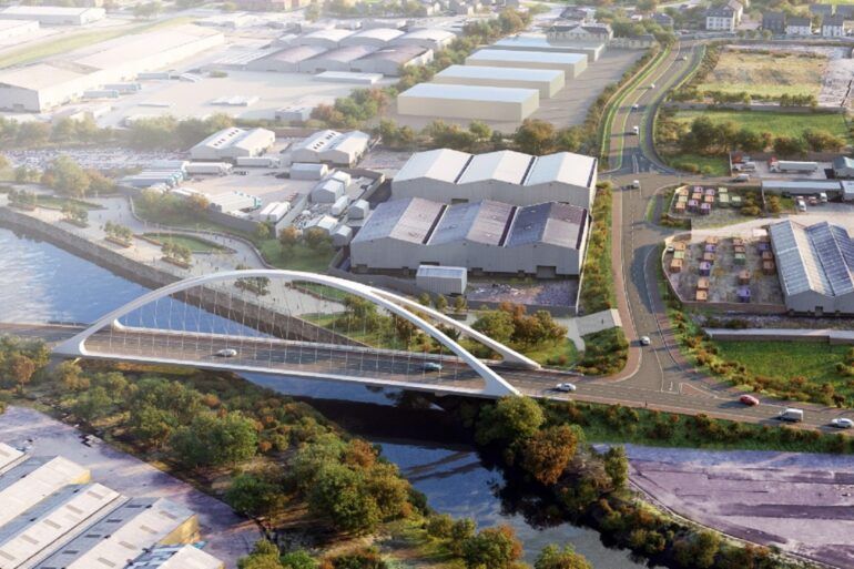
Planning consent has just been granted for the bridge and further routes along the river from Paisley town centre right out to the developing manufacturing district AMIDS next to Glasgow Airport.
It’s all about improving the connections for people either side of the river to AMIDS and to their work, studies and leisure activities.
Cutting congestion, enhancing the environment along the river and encouraging walking and cycling, the improved transport links will also help local business growth by improving access for customers and suppliers.
In fact, the completed works could attract an additional £136million into the local economy and cut carbon emissions by more than 4,200 tonnes.
It is expected to be in place in 2025 and is being funded through the UK Government’s Levelling Up Fund.